| Below Nottely Dam A few historic subjects... March 2025 |
All Text & Images: Copyright (2025) |
| Below Nottely Dam A few historic subjects... March 2025 |
All Text & Images: Copyright (2025) |
| I've been meaning to go down along the river below Nottely Dam for a while now, as there are a few historical subjects that I wanted to photograph. After an afternoon of rock-hounding nearby, I finally made a quick first-time visit. |
|
 |
|
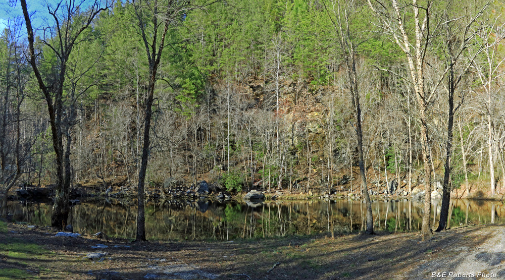
| This pond is at the NW end of one of the two large quarries used to excavate the earth and stone for building the Lake Nottely Dam. The other quarry is under the lake, about 300 feet upstream from the intake tower. |
|
 |
|
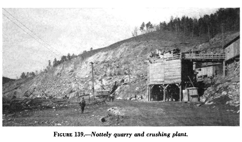
| Nottely Project - Quarry 1 during construction, 1941 An overgrown old road still leads up to the crushing plant unloading level. The current quarry pond would be back at the far left. |
|
 |
|
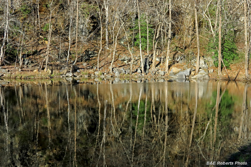
| Reflections in the quarry pond. |
|
 |
|
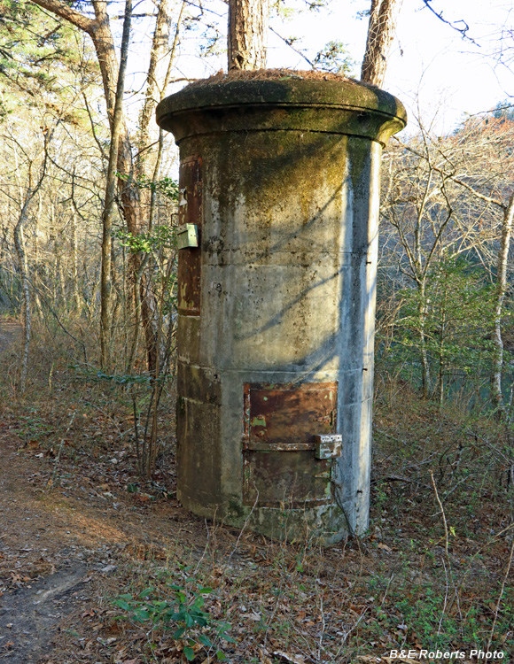
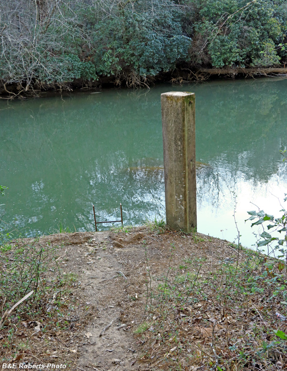
| Nottely River Water Gauge 03553500 This gauge station measured water discharge from the lake from July 1, 1942 to Sept. 29, 1975. |
|
 |
|
| Water level post and ladder to the river. |
|
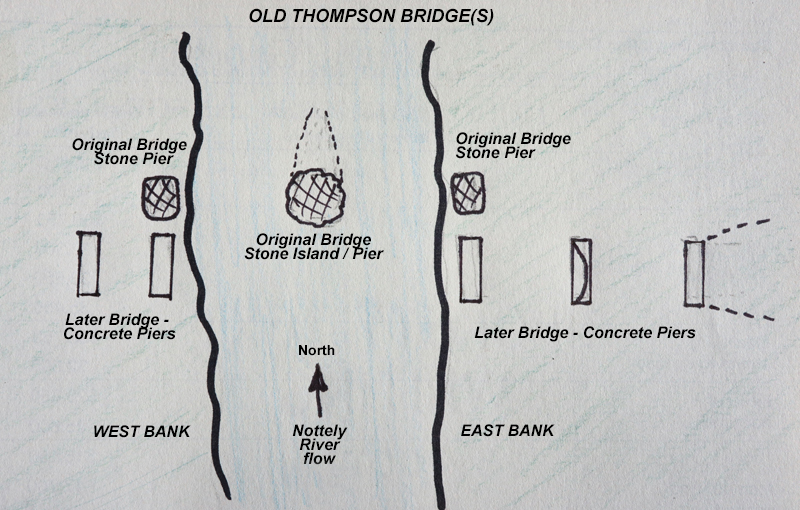
| Old Thompson Bridge(s) Thompson Bridge shows on the 1911 topo, but it and the roads leading to it are gone on the 1935 map. When I got there, I could see the remains of two different bridges adjacent to each other. The original (northern) bridge had a single stone pier on both banks, with a rip-rap island in the river between them that once held a center pier. Immediately to the south was a later bridge, with 3 raised concrete piers on the eastern bank, and at least 2 visible concrete piers over on the west side. |
|
 |
|
| Sketch showing the layout of the remains of the two Thompson Bridges. |
|
 |
|
| From the most eastern concrete pier, looking west. The 3 piers on the east bank can be seen, as well as one across the river. |
|
 |
|
| From the lip of the most eastern concrete pier, looking west. The next 2 piers on the east bank can be seen, as well as one across the river. |
|
 |
|
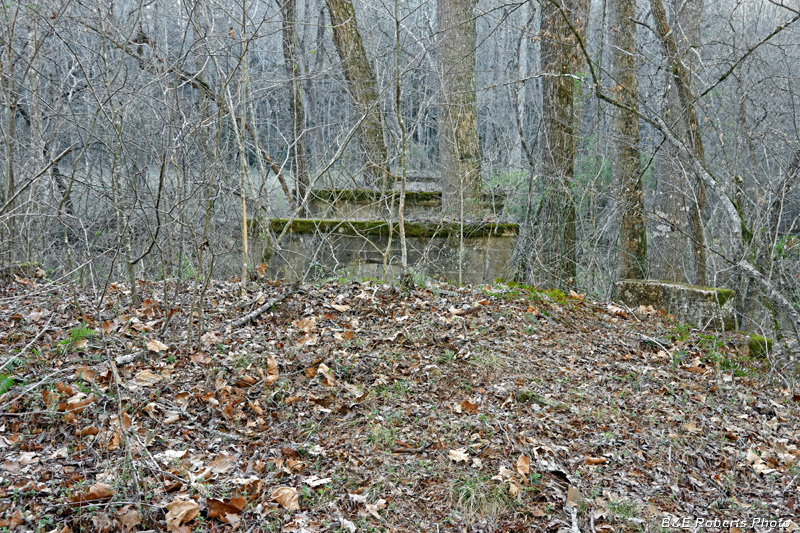
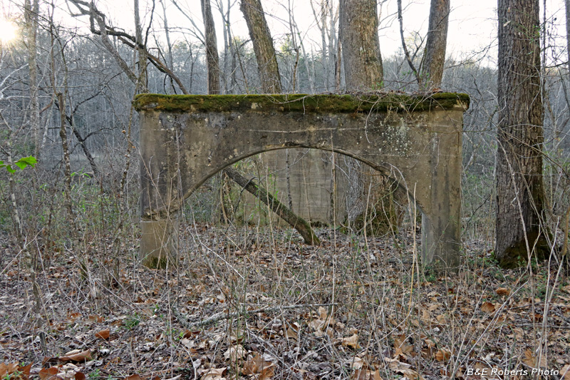
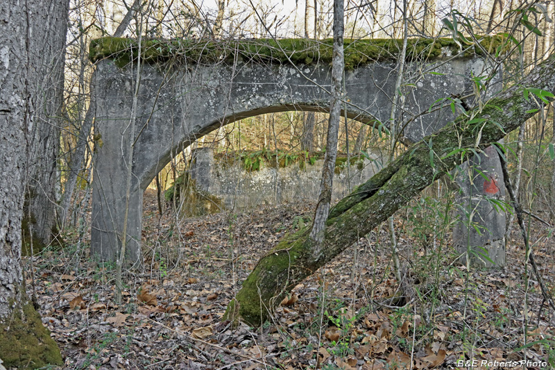
| Continuing westward, the arched second pier and the third pier that sits on the river bank. |
|
 |
|
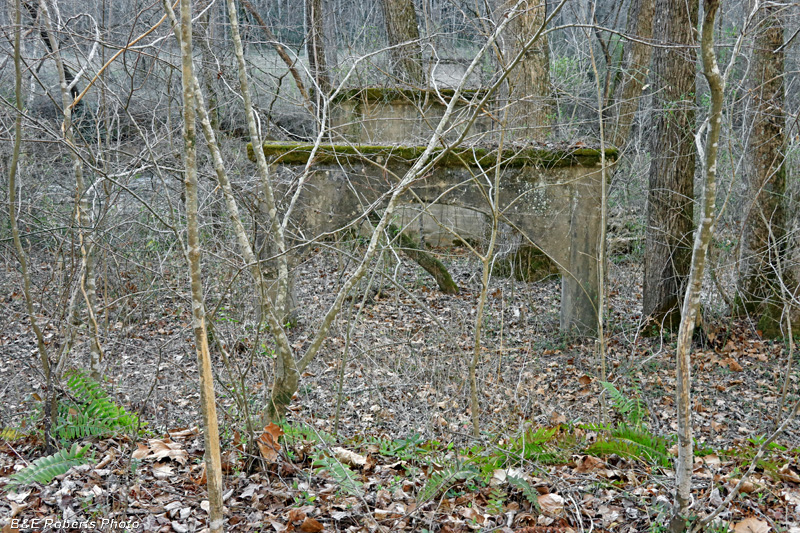
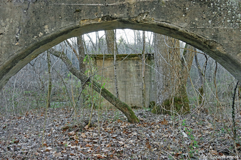
| View through the arched second pier toward the third pair. |
|
 |
|
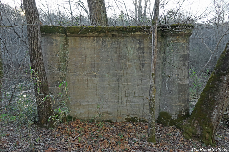
| Turning around and looking back (easterly) to the first (approach) pier. |
|
 |
|
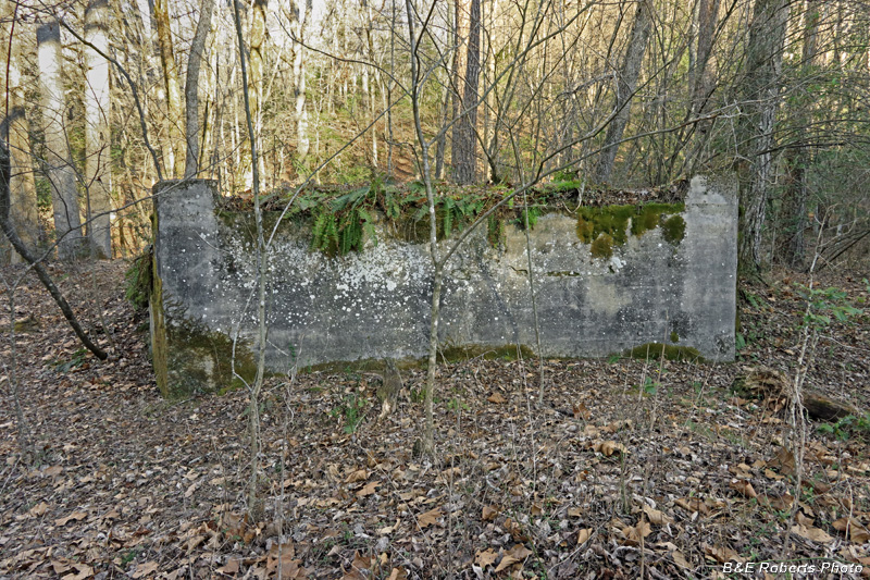
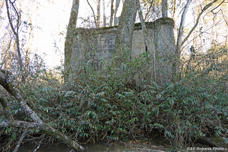
| Third (riverside) concrete pier on the east side. |
|
 |
|
| Looking back at piers 1 and 2 (arch) on the east side. |
|
 |
|
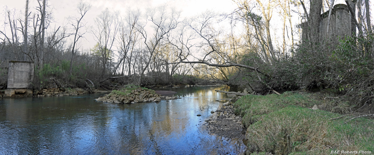
| From down on the riverbank just upstream from the bridges: The western and eastern riverside concrete piers of the later bridge, and the rock island that held the mid-river pier of the original bridge. |
|
 |
|
| Looking up at the eastern riverside pier from water's edge. |
|
 |
|
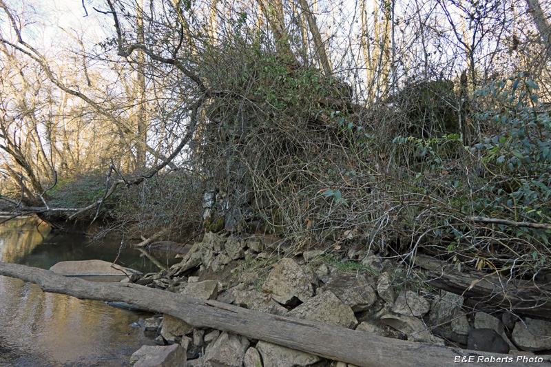
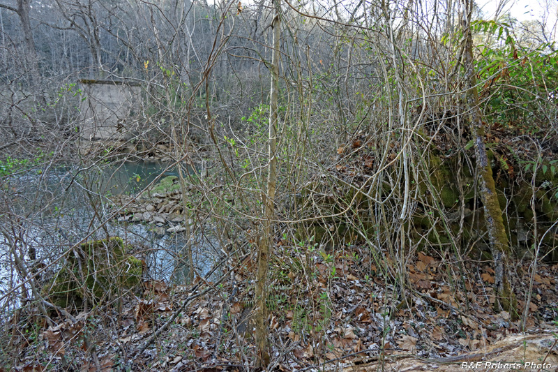
| View of the adjacent, vine-choked rock eastern pier of the original bridge. |
|
 |
|
| Not a good pic with the undergrowth covering the rock pier on the right, but (from L-R), western side concrete pier, mid-river rock island / pier, and eastern rock pier. One can also barely see the other rock pier of the original bridge, just to the right of the concrete pier across the river. |