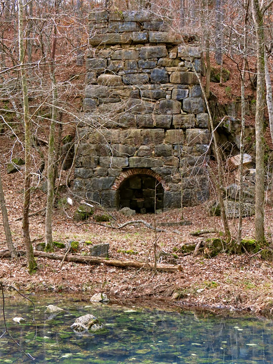
| Akin Lime Kiln, on Limekiln Branch near Kingston, GA |
All Text & Images: Copyright (2013) |
| Akin Lime Kiln, on Limekiln Branch near Kingston, GA |
All Text & Images: Copyright (2013) |
 |
|
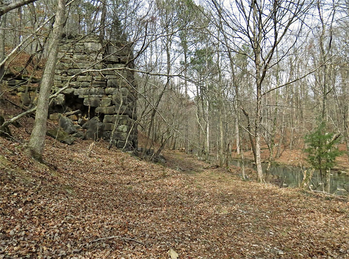
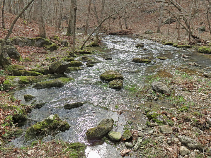
| Approaching the lime kiln, Limekiln Branch is on right |
|
 |
|
| The quarry was behind the kiln, to the left. |
|
 |
|
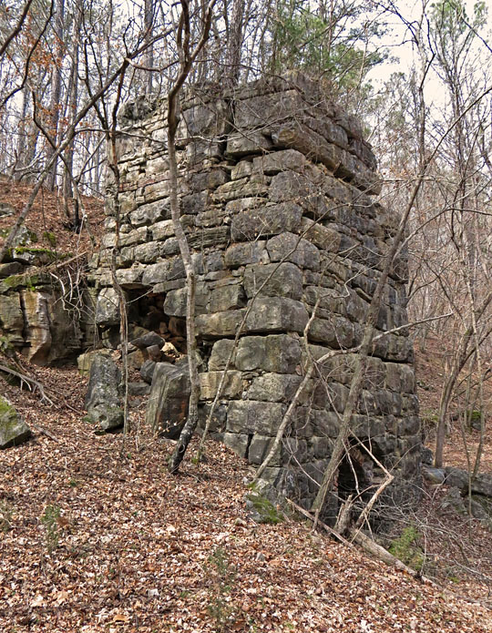
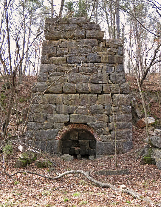
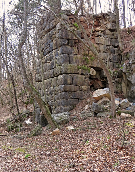
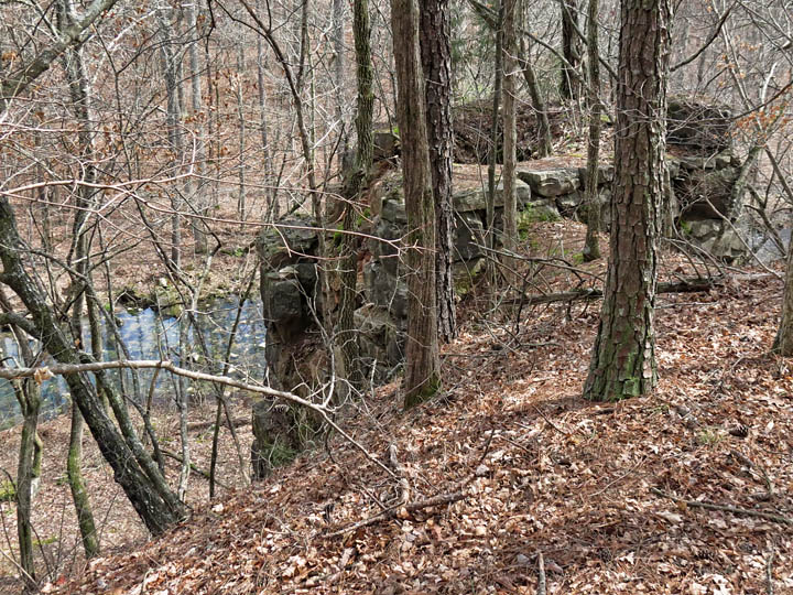
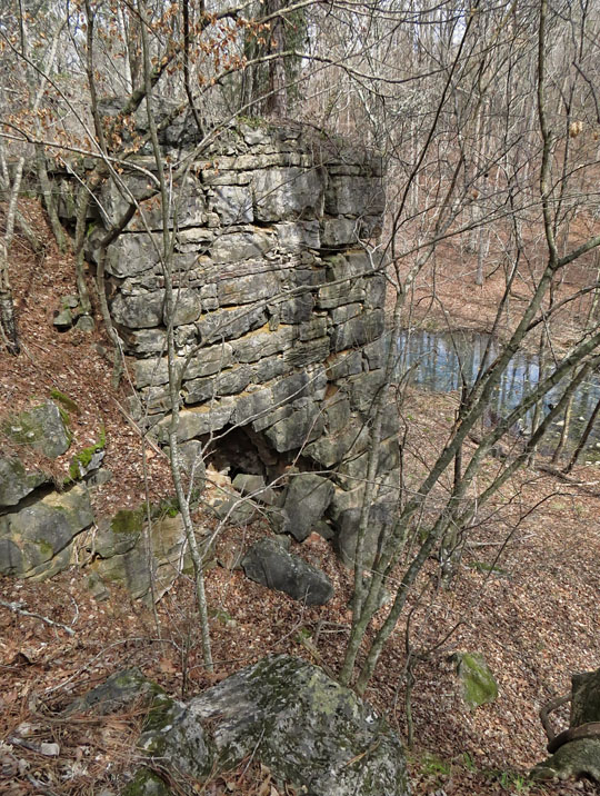
| Front (east) side of kiln, facing the creek This is probably the most robust kiln that I have seen in GA. It was constructed much like the nearby iron furnaces. |
|
 |
|
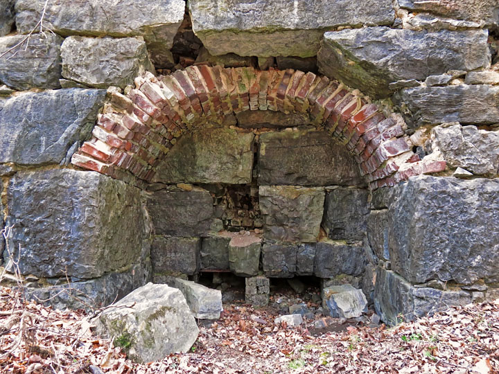
| Kiln eye (air inlet) |
|
 |
|
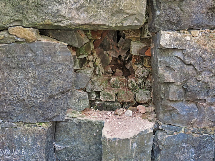
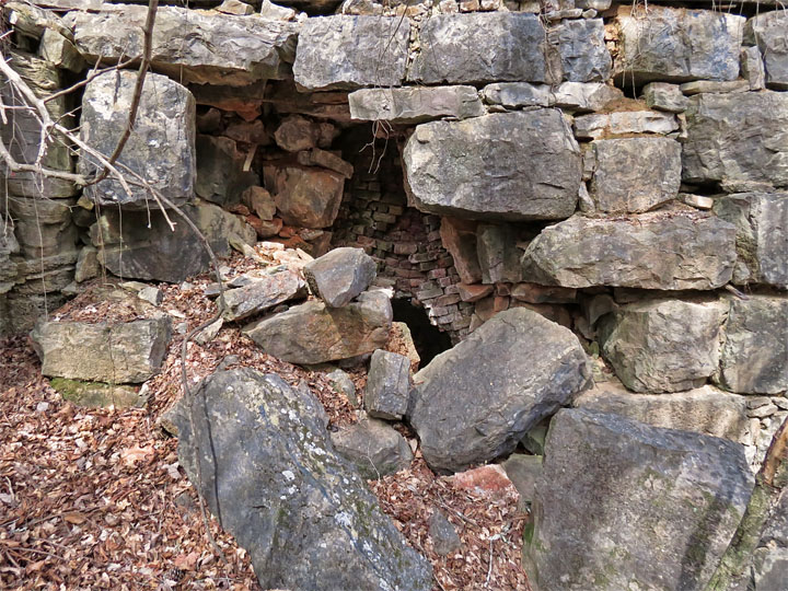
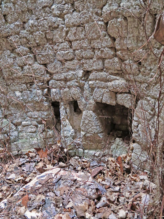
| Large stone block has been removed here, and the brick crucible broken. |
|
 |
|
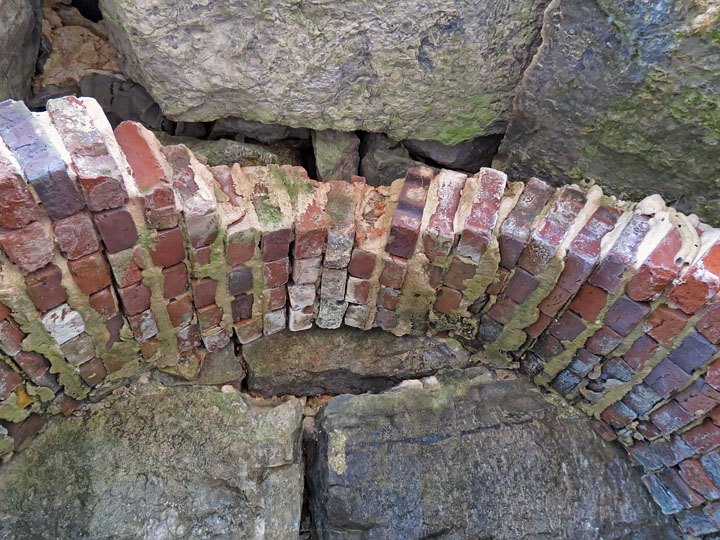
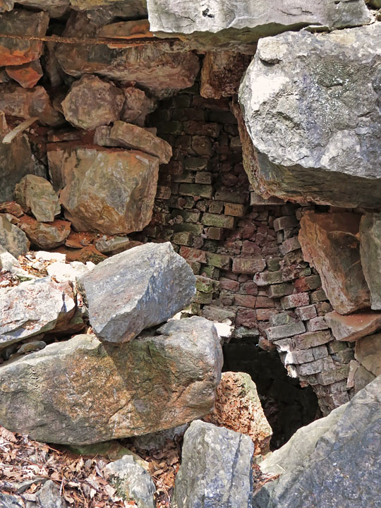
| Brick arch in kiln eye |
|
 |
|
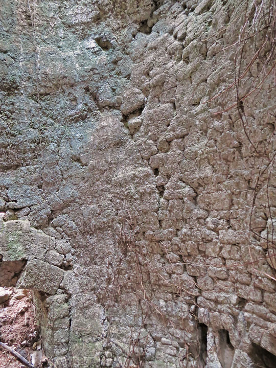
| The top of the kiln's north side is collapsing. The space between the exterior block walls and the brick fire chamber was typically filled with loose stone and dirt for insulation; this is visible where the large exterior stones have fallen. |
|
 |
|
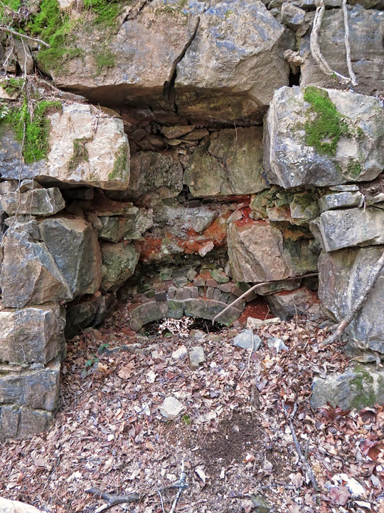
| Arched opening on north side was probably for unloading the kiln. It is partially filled with debris from the wall collapse above. |
|
 |
|
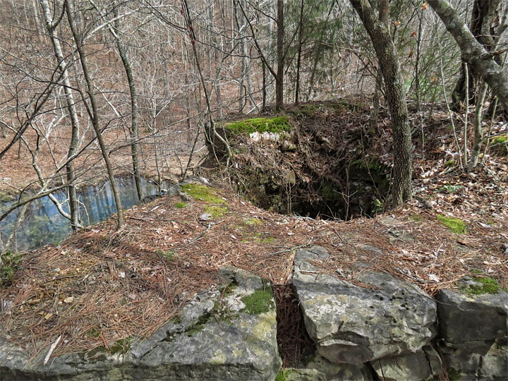
| The kiln was built into a slope for access to the loading hole at top. |
|
 |
|
| Top of the kiln |
|
 |
|
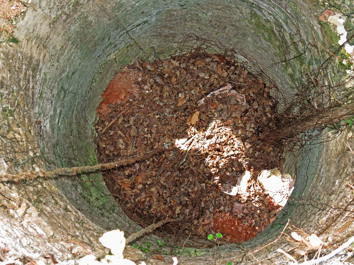
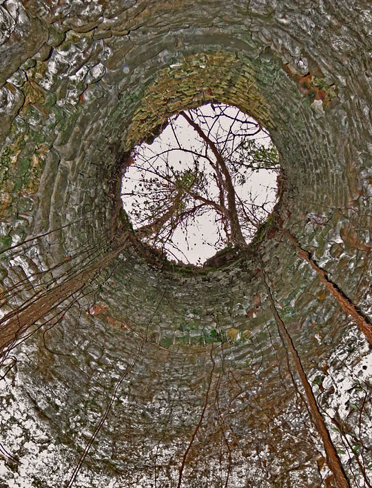
| Down the chimney |
|
 |
|
| Upper section of chimney shaft |
|
 |
|
| Side view of kiln from upper slope. |
|
 |
|
| Breached south wall |
|
 |
|
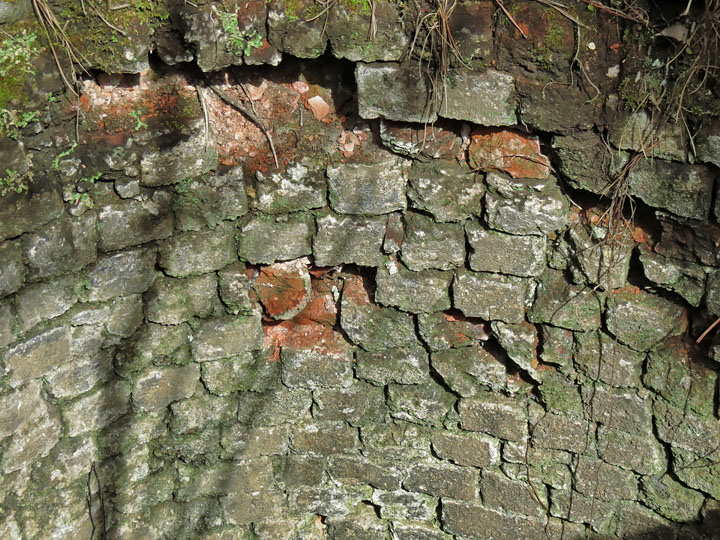
| Brick burning chamber visible through breached stone wall |
|
 |
|
| Interior wall of fire box |
|
 |
|
| Front air inlets |
|
 |
|
| Looking up the chimney |
|
 |
|
| One of the unloading opening arches |
|
 |
|
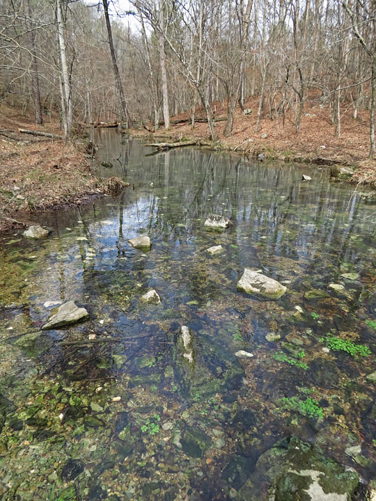
| Limekiln Branch, from the bank in front of the kiln. |
|
 |
|
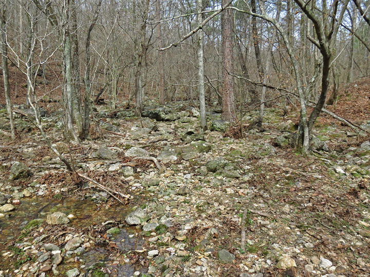
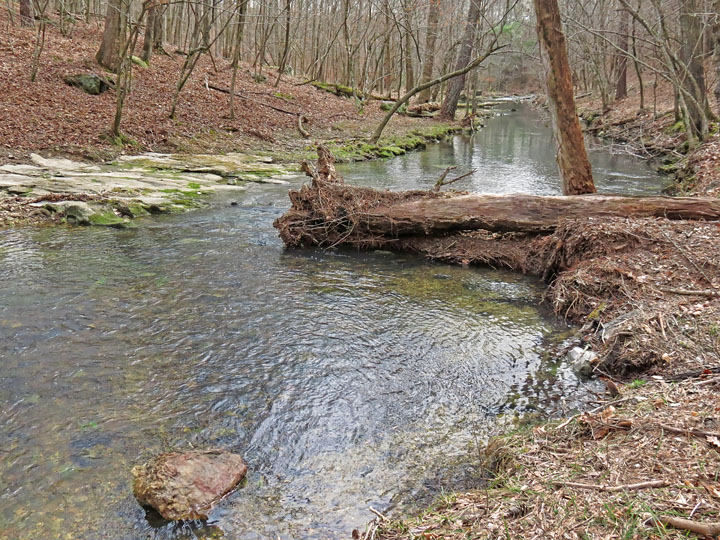
| About 150 yards upstream, the branch seems to disappear in this rocky bed. |
|
 |
|
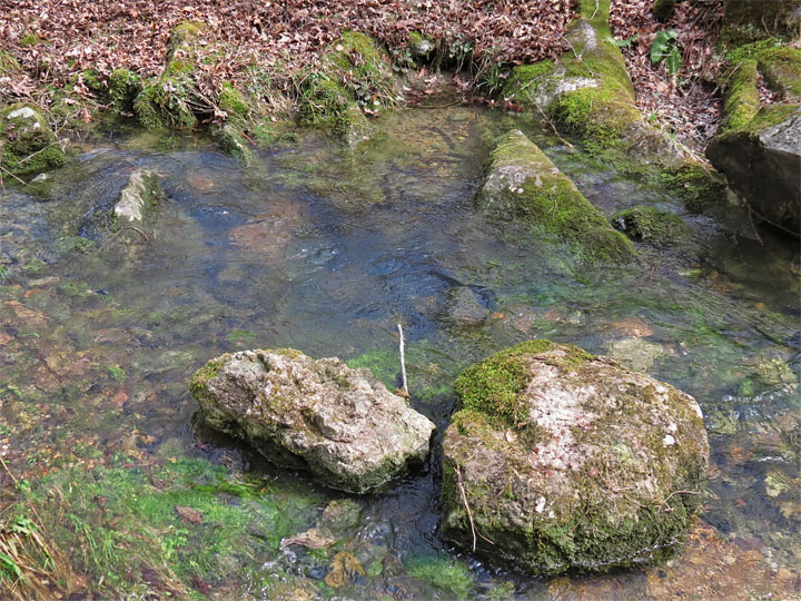
| That's because most of the flow is coming from Rodgers Spring, here alongside the creek. |
|
 |
|
| The water from the spring (left) flows into the main creek branch. |
|
 |
|
| Limekiln Branch |
|
 |
|
| Kiln from the opposite side of the branch. |
|
 |
|
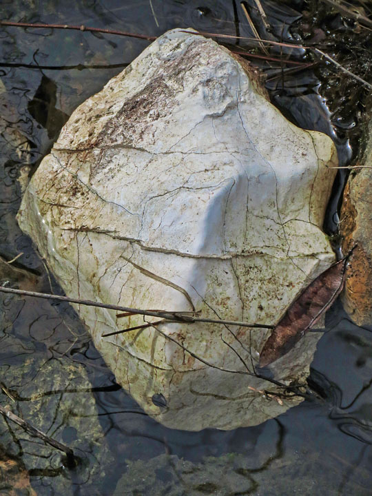
| Chunk of limestone in the creek. |
|
 |
|
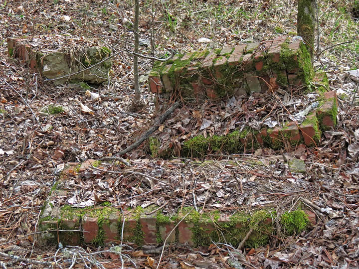
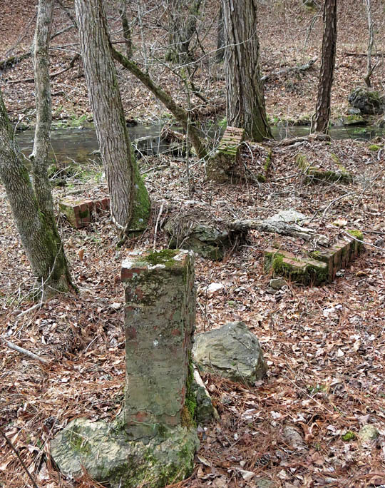
Brick wall columns from another old structure, directly across the branch from the kiln. |
|
 |
|
 |
|
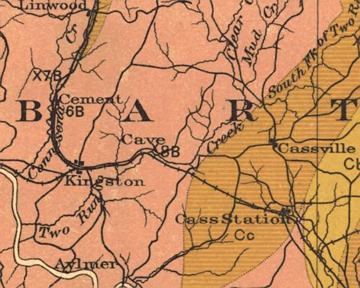
| From GA Bulletin No. 27, showing the Akins Lime operation (location marked 8B). |
|
 |
|
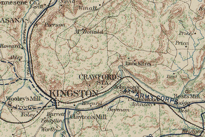
| From Official Atlas of the Civil War, showing more than one lime kiln in the area. All I ever found was the one... |